The Lower Beane
Impacts of industry
Once joined by the Stevenage Brook (which flows continuously all year round) the river south of this confluence (just to the north of Watton at Stone) is referred to as the Lower Beane, all the way to Hertford.
From the confluence southwards it runs through more populated areas and has seen further modification over the centuries, again to power mills but also owing to landscaping within formal parkland.
The river runs along behind the High Street of Watton, where it used to power a large mill and passes through a public green space called The Lammas.
Slowing the flow
As the Beane leaves the southern end of Watton it turns briefly east and then south again into the parkland of the Woodhall Estate.
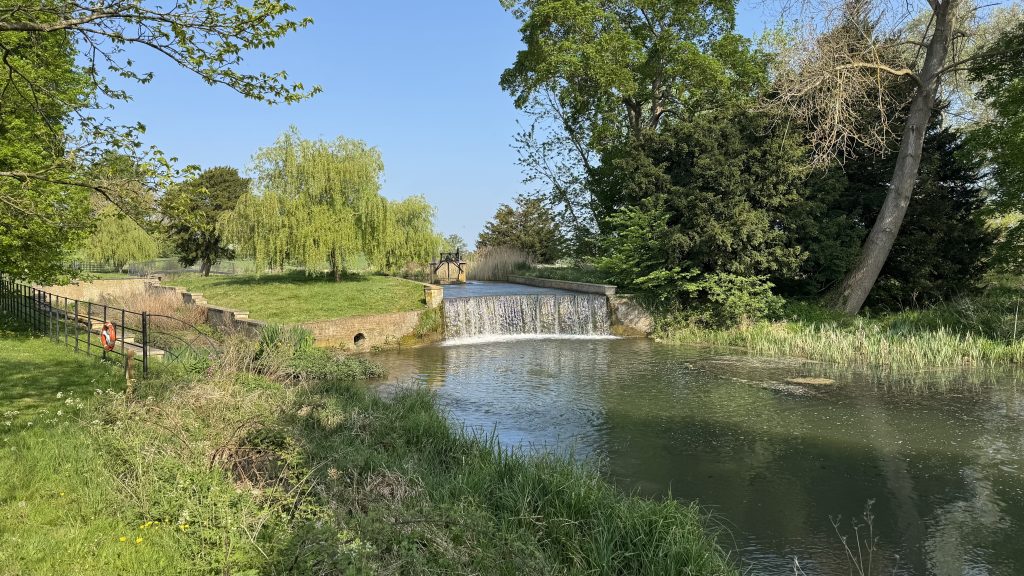
Around 1780 a significant weir was formed across the river within Woodhall Park, creating the Broad Water lake behind it. This structure, and the surrounding parkland is listed by Historic England.
Further weirs within Woodhall Park added to the impounding effect that led to excess siltation of the river through being slowed by these weirs, also preventing the upstream passage of fish. Another channel, the Dane End Tributary joins the Beane here, although this stream is dry for much of the time.
Restoration projects
Since 2017, the Woodhall Estate has worked in partnership with Affinity Water to carry out extensive restoration projects to the River Beane as is passes through Woodhall Park, including bypassing these large weirs and ‘rewiggling’ the channel to recreate a much more natural river profile or morphology, and reconnect the river to its floodplain.
Read more about this work from the Woodhall Estate website.
South of Woodhall Park the river has in the past been artificially deepened and straightened, to dry out the valuable grazing land between it and the parallel Stapleford Marsh Ditch, and possibly to power a long-lost mill at Bulls Mill. Further restoration work has recently been completed here, again carried out by the Woodhall Estate and partners, to put the river back nearer its original course and profile and to allow it to flood the land alongside. You can see more about this latest work from the scheme designer’s website: latest phase of restoration.
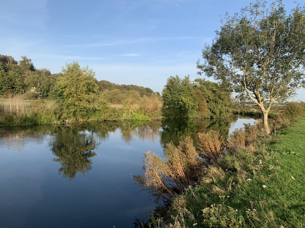
At Waterford, the river and Stapleford Marsh ditch combine again shortly after the site of the former Waterford mill, which burned down in 1870.
One of the most attractive stretches of the Beane is in Waterford, where a public path runs alongside it across Waterford Marsh. River improvement works were carried out here by the Environment Agency and the Countryside and Rights of Way Service of Hertfordshire County Council to remove unsightly concrete walls and improve the marginal habitat.
The end of the river's journey
Continuing its southward journey the river ducks beneath the main Hertford Road and into the parkland of the Goldings Estate.
Here, as at Woodhall, extensive changes were made in the 19th century to alter the river to form a lake, confusingly called the Goldings Canal.
South of Goldings the river flows across broad flood meadows before passing alongside the Herts and Middlesex Wildlife Trust’s Beane Marshes reserve, then flows over a substantial weir at Cedar Close as it enters Hertford.
The presence of these various weirs and obstructions along its length is one reason for the River Beane being graded as ‘poor’ under the Water Framework Directive as they lead to impoundment, siltation and prevent fish passage. Work to provide a fish bypass to the Cedar Close mill is due to start during 2026.
Through Hertford itself the river shows signs of significant alteration as it passes the former Sele Mill and runs through the town in a series of often brick or concrete lined channels.
As it leaves Hertford, the River Beane widens out and becomes a wide, deep and majestic sight as it flows along the north side of Hartham Common. The Beane flows into the Lea at this point, at the end of its 30km journey.